CELEBRATING 80 YEARS: 1944-2024
COAST PILOT SERIES

COAST PILOT SERIES

no reviews for this product. Login to place a review.

ProStar Publications "Coast Pilot" covers a wide variety of information important to navigators of U.S. coastal and intracoastal waters and the waters. Most of this book information cannot be shown graphically on the standard nautical charts and is not readily available elsewhere. The subjects include, but are not limited to, channel descriptions, anchorages, bridge and cable clearances, currents, tide and water levels, prominent features, Pilotage, towage, weather, ice conditions, wharf descriptions, dangers, routes, traffic separation schemes, small-craft facilities, and Federal regulations applicable to navigation.

Features (Click to expand):
  • Size: 8-1/2" x 11"
  • Published by NOAA and Distributed by FAA
  • Coverage Areas (Click to expand):
    • Coast Pilot #7: Coasts of California, Oregon and Washington, and includes Hawaii and other United States territories in the South Pacific
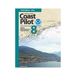
    • Coast Pilot #8: Panhandle section of Alaska between the south boundary and Cape Spencer
    • Coast Pilot #9: Pacific and Arctic coasts of Alaska from Cape Spencer to the Beaufort Sea
    • Coast Pilot #10: Oregon, Washington, Hawaii and Pacific Islands
    00P

    COAST PILOT #7 PACIFIC COAST CA
    BKS-CP7
    Available: 3
    $30.00
    COAST PILOT #8 AK DIXON TO SPNCR
    BKS-CP8
    Available: 6
    $30.00
    COAST PILOT #9 SPENCER TO BFRT
    BKS-CP9
    Available: 3
    $30.00
    COAST PILOT 10 OR WA HI S PAC
    BKS-CP10
    Available: 18
    $30.00