Back to Main Menu
Account Menu


no reviews for this product. Login to place a review.
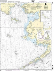
NOAA Nautical Charts for the Alaskan Coast are printed on water resistant paper and are NOAA and USCG approved.
| ITEM # | LOCATION | SCALE |
|---|---|---|
| CHT16006 | Bearing Sea (East)St. Matthew IslandCape EtolinAnchorageNunivak Island | 1:1534076 |
| CHT16013 | Cape St. Elias to Shumagin IslandsSemidi Islands | 1:969761 |
| CHT16520 | Unimak/Akutan Passes & ApproachesAmak Island | 1:300000 |
| CHT16700 | PRINCE WILLIAM SOUND | 1:200000 |
| CHT16760 | Cross Sound to Yakutat Bay | 1:300000 |
| CHT17300 | Stephens Passage to Cross SoundLynn Canal | 1:209978 |
| CHT17360 | Etolin Island to Midway IslandsSumner Strait | 1:217828 |
| CHT17400 | Dixon Entrance to Chatham Strait | 1:229376 |