Back to Main Menu
Account Menu
no reviews for this product. Login to place a review.
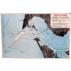
The Columbia River Entrance Photo Chart is a laminated map composed of multiple aerial photographs and is intended as a visual aid only and should not be used for navigation purposes. It covers Southwest of "CR" Buoy 1 to North of North Head Lighthouse and East as far as Astoria and Point Ellice. Soundings are in feet and courses are magnetic.