Back to Main Menu
Account Menu
no reviews for this product. Login to place a review.
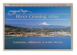
The Evergreen Pacific Publishing River Cruising Atlas contains large-scale reproductions of NOAA charts for the Columbia, Snake, and Willamette River. Charts include the Columbia River from the mouth to the Tri-Cities, the Snake River from the Tri-Cities to Lewiston, and the Willamette River from Portland to Newberg. Major facilities and services, dangerous bar areas, coastal areas, Hanford Reach, a Lower Snake Recreation guide, the United States Coast Pilot for all three rivers, and charts for Ilwaco Harbor, Bonneville Dam, Hood River, The Dalles, and John Day River are indicated in the atlas.


